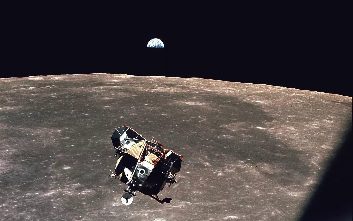
Sixty years ago, humanity achieved a pivotal moment: the first glimpse of our Earth from space. This video explores that groundbreaking moment and contrasts it with today's sophisticated satellite imagery. Witness the evolution of remote sensing technologies, highlighting advancements in Earth observation and their impact on understanding our planet's changing environment, from climate change monitoring to detailed mapping and resource management.
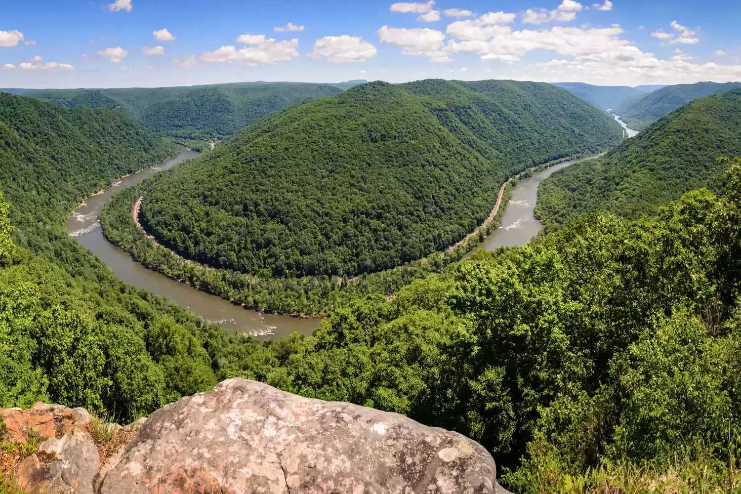
Fast forward 60 years, and our ability to observe Earth from space has undergone a dramatic transformation. From these initial, fleeting glimpses, we now possess a vast and sophisticated array of satellites, instruments, and technologies that provide a continuous and detailed view of our planet. This capability allows us to monitor everything from weather patterns and climate change to deforestation and urbanization with unprecedented accuracy.
The Evolution of Earth Observation
The journey from that single, grainy image to the sophisticated Earth observation systems we have today is a testament to human ingenuity and technological progress. Early satellites like Sputnik and Explorer provided valuable data on the Earth's atmosphere and magnetic field. The launch of Landsat in 1972 marked a turning point, providing continuous, high-resolution imagery of the Earth's land surface. Landsat's data has been used for a wide range of applications, including agriculture, forestry, urban planning, and disaster management.
Over the decades, the capabilities of Earth observation satellites have expanded exponentially. We now have satellites that can:
Measure the Earth's temperature with extreme precision.
Track the movement of ice sheets and glaciers.
Monitor the health of forests and oceans.
Detect and track wildfires in real-time.
Provide early warnings for natural disasters.
These advancements have not only improved our understanding of the Earth system but have also provided invaluable tools for addressing some of the most pressing challenges facing humanity, such as climate change, food security, and environmental degradation.
Key Milestones in Earth Observation Technology
The following table highlights some of the crucial developments that have shaped the field of remote sensing. Note how the column width adapts to accommodate the content.
Year |
Milestone |
Significance |
|---|
1946 |
First Image of Earth from Space |
Marked the beginning of space-based Earth observation. |
1957 |
Launch of Sputnik 1 |
The first artificial satellite, providing initial data on the Earth's atmosphere. |
1972 |
Launch of Landsat 1 |
Provided continuous, high-resolution imagery of the Earth's land surface, revolutionizing resource management and environmental monitoring. |
1978 |
Launch of Seasat |
The first satellite dedicated to studying the Earth's oceans, paving the way for advancements in oceanography and maritime navigation. |
1999 |
Launch of Terra |
Carries a suite of instruments for studying the Earth's land, oceans, atmosphere, and energy budget, providing a comprehensive view of the Earth system. |
Present |
Advanced Earth Observation Constellations |
A global network of satellites providing real-time data for a wide range of applications, including climate change monitoring, disaster response, and precision agriculture. The sophistication of current remote sensing instruments allows for detailed analysis of spectral signatures and data fusion, yielding unprecedented insights into Earth's dynamic processes. |
How We See Earth Now: Advanced Technologies and Data
Today, we use a variety of sophisticated technologies to observe the Earth from space, including:
Optical Sensors: Capture images of the Earth in visible and infrared light. These sensors can be used to monitor land cover, vegetation health, and water quality.
Radar Sensors: Use radio waves to penetrate clouds and darkness, providing data on surface topography, soil moisture, and ice thickness.
Lidar Sensors: Emit laser pulses to measure the distance to the Earth's surface, creating detailed 3D maps of terrain and vegetation.
Hyperspectral Sensors: Collect data in hundreds of narrow spectral bands, allowing for detailed analysis of the composition of materials on the Earth's surface.
The data collected by these sensors are processed and analyzed using advanced algorithms and machine learning techniques to extract meaningful information. This information is then used to create maps, models, and forecasts that help us understand and manage our planet.
The Future of Earth Observation
The future of Earth observation is bright, with ongoing advancements in sensor technology, data processing, and satellite design. We can expect to see even more sophisticated satellites with higher resolution, greater spectral coverage, and improved data processing capabilities. These advancements will enable us to monitor the Earth with even greater detail and accuracy, providing invaluable insights into the complex processes that shape our planet. Furthermore, the increasing availability of satellite data and cloud computing is democratizing access to remote sensing information, enabling a wider range of researchers, policymakers, and citizens to participate in Earth observation efforts.
As we continue to explore and understand our planet from space, we can gain a deeper appreciation for its fragility and the importance of protecting it for future generations. The ability to see Earth as a whole, as that first grainy image allowed us to do, is a powerful reminder of our interconnectedness and the responsibility we share to be stewards of our planet.